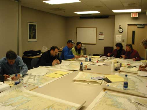
Coastal Navigation: Advanced Cruising Techniques -
Classroom Location: Spirit of Hope Church, 7600 Harold
Ave, Golden Valley, MN 55427.
Directions: Located adjacent to Hwy 55 just
west of Hwy 100 and just east of Hwy 169. From Hwy 100 exit
Glenwood Avenue and go west to Harold Avenue just one block from
Hwy 55, turn west or left. The church is on the right. From Hwy
169 exit Hwy 55 east. Turn right on Winnetka Avenue and left on
Harold Avenue. The church is on the left.
Coastal Navigation: Advanced Cruising Techniques -
ASA Course 105
Students learn
the navigational theory and practical skills required to safely
pilot a sailing vessel in coastal or inland waters with a focus
on real world, practical navigation. The course is taught in a
classroom setting with plenty of chart work to exercise various
learning segments. Students progress from dead reckoning to more
complicated piloting incorporating current, leeway, and the
integration of electronic navigation. Students become familiar
with GPS usage and are introduced to Radar basics. Students
learn to use tide and current tables, light lists, Chart No. 1,
Notice to Mariners, and other tools. Students earn American
Sailing Association certification for Coastal Navigation upon
successful completion of course. Instructors are Captain Thom
Burns, retired U.S. Navy Navigator/North Atlantic Crossing
Navigator, and Captain Steve Burns, North Atlantic and North Sea
crossings Navigator.
The evening course meets six
times and allows plenty of weekend chart/problem time. The
Saturday course meets three times. Both classes require dedicated
practice time in order to get the most out of the class.
Course
Outline for Evening Class
Day 1: NAVIGATION, PILOTING AND
CHARTS. Measuring direction and distance; utilizing the compass
rose. READING NAUTICAL CHARTS. Chart symbols: Buoys, beacons,
lights, soundings and danger symbols.
Day 2: DEAD RECKONING NAVIGATION.
Measuring and plotting direction and distance, bearings and
courses; speed-time-distance calculations, tacking upwind.
BEARINGS AND FIXES. Using hand bearing compasses; plotting more
bearings, use of soundings, deriving an estimated position,
dipping a light, bow/stern versus beam bearings. BASIC GPS
INTEGRATION.
Day 3:
CORRECTING YOUR COURSE FOR
CURRENT AND LEEWAY. Course, heading and track; determining set
and drift of current; measuring leeway. TIDES AND TIDAL
CURRENTS. Causes of tides and currents; using tables to predict
height of tide, and set and drift of current; tidal current
charts; visual indicators of current; shoaling effect; counter
currents, insetting effect. FOG NAVIGATION. DR in fog; depth
meter navigation; bearings in fog; Polynesian concepts and
visual observations; surviving with shipping; Currents in fog.
MORE GPS INTEGRATION.
Day 4: RULES OF THE ROAD. Right of
way; avoiding close calls; skipper responsibilities; lights and Dayshapes; sound signals. ELECTRONIC NAVIGATION. GPS waypoints
and routes, cross track errors, hierarchy of commands.
Introduction to RADAR. MORE GPS INTEGRATION.
Day 5:
REVIEW AND FUN PROBLEMS.
Transiting problems on Lake Superior from the Apostle Islands.
Attendance at this session is optional but highly recommended.
Day 6: EXAMINATION. Written exam
cements independent navigational thinking and completes ASA
requirements for Coastal Navigation certification.
Course Outline for Saturday
Class
Day 1: NAVIGATION, PILOTING AND
CHARTS. Measuring direction and distance; utilizing the compass
rose. READING NAUTICAL CHARTS. Chart symbols: Buoys, beacons,
lights, soundings and danger symbols. DEAD RECKONING NAVIGATION.
Measuring and plotting direction and distance, bearings and
courses; speed-time-distance calculations, tacking upwind. BEARINGS AND FIXES.
Using hand bearing compasses; plotting more bearings, use of
soundings, deriving an estimated position, dipping a light,
bow/stern versus beam bearings. CORRECTING YOUR COURSE FOR
CURRENT AND LEEWAY. Course, heading and track; determining set
and drift of current; measuring leeway. BASIC GPS INTEGRATION.
Day 2: TIDES AND TIDAL CURRENTS.
Causes of tides and currents; using tables to predict height of
tide, and set and drift of current; tidal current charts; visual
indicators of current; shoaling effect; counter currents,
insetting effect. FOG NAVIGATION. DR in fog; depth meter
navigation; bearings in fog; Polynesian concepts and visual
observations; surviving with shipping; Currents in fog. More GPS
INTEGRATION.
RULES OF THE ROAD. Right of
way; avoiding close calls; skipper responsibilities; lights and
day shapes; sound signals. ELECTRONIC NAVIGATION. GPS waypoints
and routes, cross track errors, hierarchy of commands.
Introduction to RADAR. More GPS INTEGRATION. REVIEW AND FUN
PROBLEMS. Transiting problems on Lake Superior from the Apostle
Islands. Attendance at review session is optional but highly
recommended.
Day 3: REVIEW AND EXAMINATION. Written exam
cements independent navigational thinking and completes ASA
requirements for Coastal Navigation certification.
Independent Study Class /
Correspondence. This course has been successfully completed by
several students who are remotely located. It usually requires
some time spent with a navigation instructor by email or
telephone. Cost is $125 for the correspondence course which
comes with a book/study problems, and chart. The fee includes
testing. We like to interview prospective students in this
category. Please Call.
Course Fee: $199 includes course materials:
Navigation Textbook and practice chart.
Available for purchase: Navigation instruments
by Weems & Plath.
8" Rolling parallel plotter: $18.00* - or - 12" parallel rules: $14.00*
Ultra light 7" dividers: $17.00.
Nautical Slide Rule: $19.00.
Chart Protractor: $20.00.
Chart No. 1: $12.00.
Coast Guard Navigation Rules: $13.00. (All prices include
tax.)
*Both instruments are
ideal for chart books.
CLASS SCHEDULE:
Fall 2009 (Dates are subject to change)
3-hour evening sessions 6-9 PM (or as close as possible) or
7-hour Sat. sessions 9AM-4PM
N1: 6:00-9:00 PM Thursday Evenings
10/22, 10/29, 11/5, 11/12, 11/19, 12/3 (Exam)
N2: 9AM-4PM Saturdays, with lunch break
10/31, 11/7, 11/14 (Exam)
This is an intense class due to the three Saturdays of
seven hours per day. Please allow time for study and practice
problems in addition to our normal in-class problems.
Jan 2010 (Dates are subject to change)
7-hour Sat. sessions 9AM-4PM
N3: 9AM-4PM Saturdays, with lunch break
1/2, 1/9, 1/16 (Exam)
This is an intense class due to the three Saturdays of
seven hours per day. Please allow time for study and practice
problems in addition to our normal in-class problems.
Call Northern Breezes
Sailing School at 763-542-9707 to register or with questions.
Prerequisite for this course:
None. This course along with Basic Cruising - ASA 103 and
Bareboat Charter Certification - ASA 104 are prerequisites for
Advanced Coastal Cruising (long offshore passages).

Northern Breezes
Sailing School
3949
Winnetka Ave. N.
Minneapolis, MN 55427
Call For Free Brochure (763) 542-9707
American Sailing
Association
Sailing School
TOP
|