
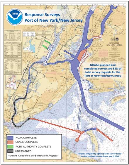
NOAA survey vessels searching for dangers to navigation in Sandy's wake
NOAA Office of Coast Survey navigation response teams and other survey assets are in the water (or soon will be), as they begin checking for underwater debris and shoaling that may pose a risk to navigation. Tasked by the U.S. Coast Guard Captains of the Port, these vessels can use multibeam echo sounders or side scan sonar, as conditions warrant, to search for the answers that would speed resumption of shipping and other vessel movements.
Bonus photo for the day: Ensign Brittany Anderson, onboard the Thomas Jefferson, captured this picture of one of the TJs high-tech survey boats (called a launch), as they left to survey the East River this morning.
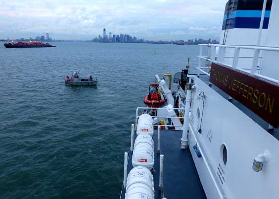
A Thomas Jefferson launch heads out to survey the East River. Photo by Ensign Brittany Anderson, NOAA
For updates on navigation response to Sandy, or to read earlier posts on the response, check the NOAA Coast Survey blog.
TOP
|