
New chart for shipping channels between Lake Superior, lower Great Lakes
St. Mary's River gets new chart 14887
Vessel operators transiting St. Mary's River, between Lake Superior and the lower Great Lakes, have a new nautical chart to help lessen the dangers inherent in this narrow and complicated waterway. The first edition of Chart 14887 (St. Marys River - Vicinity of Neebish Island) is now available as a paper print-on-demand chart, PDF, and raster navigational chart. The electronic navigational chart will be available by March, in time for the beginning of the shipping season.
Chart 14887 corrects shoreline and feature positions from earlier charts.The red lines show the shoreline before applying newly acquired data.
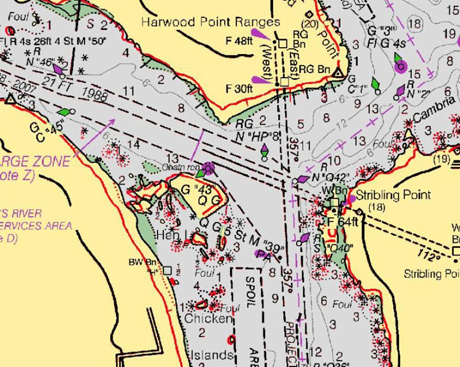
Chart 14887 corrects shoreline and feature positions from earlier charts.The red lines show the shoreline before applying newly acquired data.
Coast Survey has built the chart from original sources, providing the highest standard of accuracy for hydrographical and topographical features and aids to navigation. The chart provides large-scale (1:15,000) coverage of the up bound and down bound channels of the St. Mary's River - one of the busiest waterways in the nation. Over 4,100 transits of commercial and government vessels move about 75 million tons of cargo through the 300-day shipping season.
TOP
|