by Bruce Parnham
| Australia to Thailand by Bruce Parnham |
|
Well, here comes the first installment of the rambling travels of your
friends on RPhurst. In 2000 I covered about 4,200 miles, with a second crossing
of the equator and passing the halfway point in my circumnavigation.
Australia
From a sailing perspective my time in Australia was six months of sitting in a
marina while time was spent on land touring and boat projects. With no major
repairs to be done many of the projects consisted of dress up and maintenance
work. A new hard top bimini was made and installed, engines serviced, soft
awnings repaired and modified to match the new hard top. This has been a
worthwhile addition as the old soft top was deteriorating and beginning to leak,
believe me it is cold and no fun sitting under an awning designed to keep you
dry only to find so many leaks making it difficult to find a dry spot. I also
incorporated a rain water catchment system into the new top. I can now catch
more water than I need. This reduces reliance on the water maker when it rains.
Sail timing in Australia is critical. The cyclone season, December through April
in the north, does not allow departure from our southerly safe harbor before
April. You also must be clear of the cyclone area before the season starts again
in late November. The distances to travel are immense: Brisbane to Cape York -
1173 miles and Cape York to Darwin - 734 miles, for a total of 1907 miles
between April and August. Additionally, there is the Great Barrier Reef to
consider with great expectation of excellent diving.
The other cruising difficulty is that much of the Barrier Reef is not
sufficiently charted. The dive operators and fishing boats know their way
around. The dive boats will not assist you in finding their dive sites, so I
talked with many of the local fishing boats for their favorite anchorages out on
the reef. This information was invaluable because they know where to hole up in
what weather and how to get into the snug holes in the reef. Much of the water
around the reef is deep, 100 feet, with the reef often rising above water at low
tide. Many of the reefs can be seen with good light. If we were to move only
between 10:00 a.m. and 2:00 p.m., on clear days, we would be safe. However, with
the distances to travel and wanting some time to stop on the reef we needed to
move more hours than this would allow. The other alternative would be to stay
within the recognized shipping channels, which are very well charted. But this
would not allow us to see the sights along the way and isn't that the reason for
doing the trip?
The most incredible sight on the reef was a place called Line Reef, well named
for its effect on the tide flow. At high tide it is merely a shallow reef. At
low tide, the water is contained by its length of several miles. With few holes
through which the water may flow it creates water falls and flowing rivers.
Miles out at sea you will find white water rivers as swift as most rafting
rivers. We anchored close enough for a clear view of it. This is the area where
we found the clearest water, however it was very cold for diving, wetsuit
temperatures. As this is early spring we found the air and water temperatures
along the reef to be very cold along this coast. The outside of the reef
benefits from a warm current from the north which promotes coral growth. That is
not an area for short hopping up the coast. Some of the cruisers stayed to the
outside of the reef, making good time with few stops. They reported warm air and
water temperatures.
The Whitsunday Islands are one of the most popular cruising areas along this
coast. With several islands within easy day sails, many hotels, boat charters,
and tourist services, it attracts sailors, backpackers and tourists from all
over Australia and to a lesser extent other parts of the world. Most of the
cruisers traveling along the coast plan to spend some time in the Whitsunday's.
This section of coast is not very friendly to a boat with an animal. Many of the
towns have a marina with a break wall but no anchorages. With the four legged
beast we are not permitted to tie up to a dock so this presents a problem. We
found rivers or bays in which we could anchor using the dinghy to get back and
forth. Macay, a port of entry, has no facility for anchoring so after
discussion with quarantine we tied up to a work barge anchored in the harbor,
paying the same price as we would have tied to
the dock space. Our time at Townsville was spent anchored in the
protection of the break wall. The government built, but privately managed marina
has security guards that watch over dinghies coming to shore from the pond. The
guards are instructed to assure none of these cheapskates tie up to the dock,
deposit their trash into bins or use any of the marina facilities. When we
explained to them that it is their government that does not allow us into the
marina, it fell on unsympathetic ears! We beached the dinghy in an area that
excludes the use of powerboats and is affected by large tidal ranges and swell.
Townsville provided my first opportunity to tour a U.S. war ship. Two cruisers
were in the harbor with one offering public tours. The incongruity of traveling
half way around the world to be allowed access to one of our ships on which I
have purchased at least one bolt was not lost on any of us. The tour was
interesting and the sailors were amazed and amused that we had traveled from the
U.S. by sailboat. While we have often encountered U.S. Navy presence this was
the first time a tour was offered.
Sailing north along the Queensland coast is quite enjoyable, with periods of
wind changing in patterns from a few days of none, to a few days of mild, to a
few days of boisterous. I was reminded of sailing at home. It seemed the only
time the wind would remain in the 25-30 knot range was when we were to spend
time at the reef anchorages. These winds make great sailing, but can make for an
uncomfortable anchorage when in an area that prohibits any after dark movement.
The need to find sheltered anchorages was even more important. Fortunately we
always did and never dragged or needed to move. The radio weather forecasts were
for different regions of the coastline and were pretty accurate. Once I
discovered the areas for reporting I only needed to listen for the report for my
area. The weather faxes for the coast were next to worthless as they included an
area of several hundred thousand square miles and lacked sufficient detail
except to anticipate major changes.
On our June arrival at Townsville my companion Jean informed me she was
returning home to a more normal life. This required me to begin picking up crew
along the way as it is unsafe to make passages alone. The need for rest does not
allow an adequate watch to be kept. With friends from Minnesota joining me in
Townsville and leaving from Cairns I began my search for crew in Cairns. This
has been a new experience, some good some not so good. I have been very
fortunate in finding individuals who made good crew.
At Cairns I found three - Erin, an Israeli, Kim, a Dutch and Rob, a Brit, all
wishing to learn to sail. With a need to make many day sails inside the reef,
they had an opportunity to learn in short lessons. It was a good experience for
me to again teach raw beginners the operation of a boat. All participated in
sail trim, cooking, steering and learning about cruising. They all left the boat
at Darwin after three weeks.
At Darwin I found two - Teal, an Aussie, and Phil, a Brit, both wishing to make
the whole trip to Thailand. Teal learned quickly, was conscientious, a pleasure
to be around and stayed with me to Thailand. Picking up crew will now be another
responsibility before each new segment of my travels. Repair the boat, get
provisions, find crew, plan the passage and on and on. Such is the relaxed
cruising lifestyle.
Fishing along the Queensland coast was disappointing. I expected we would fill
the freezer with fish to be used while on the ocean crossing segments, but we
had fish in smaller quantities than expected. Spanish Mackerel in the 10-30
pound range gave us some excitement and a good food source. We had several
sightings of pods of dolphins, many swimming with us to the delight of the new
crew, I never tire at the tremendous sight of breaching Humpback whales.
Indonesia
The passage from Australia to Indonesia was a non-event. A 462 mile passage
should take us about four to five days. We motored for six days straight,
interrupted by short periods of "sailing": put up the sails, not enough wind
from the right direction, take them down and finally motor some more. We not
only had light wind on the nose from the wrong direction, we also had an adverse
current of up to one and a half knots. This considerably affected our speed over
ground and distance. For every mile motored we only made three quarters of a
mile toward our destination. Very slow! While I knew we would be faced with
light wind and much motoring as we moved closer to the equator, I did not expect
it to begin so soon. Fuel would become a critical issue during most of our
passages from now on.
Our August 22nd arrival at the island of Roti, Indonesia was marked by a final
four hour burst of speed, both motors running with the spinnaker up in light
air. If we could cover enough miles we could arrive at the island before dark.
If not, we would need to hold off until daybreak. We did make the anchorage in
daylight, but not as far into the bay as we would like as we ran out of fuel
after crossing the reef. We again put up sails and moved as close as we could
and then had to drop anchor where we were. A good thing fuel was available
there. All of our friends were also short of fuel on arrival.
Roti was only interesting as a first landfall. We did a bus trip to the largest
town on the island, barely larger than a village, for provisions and banking.
The roads were a real eye opener. Two and a half hours to travel 30 miles
dodging around potholes, washouts and construction zones. This was also our
introduction to the litter and waste that can be more apparent in third world
countries. One of the worst materials provided by the industrialized world to
this country is plastic in the form of bags, bottles, containers and wrapping as
all are discarded in vast quantities. It never goes away. We found that the
redeeming quality of the area is the people. They were outgoing, friendly and
curious, eager to practice their English or get by with a little sign language
and much laughter. They really were a pleasure to meet.
From Roti we moved to the Island of Flores. Here we found larger towns with more
facilities, banking, restaurants, Moslem Mosque and land touring. This is the
home of Kerimotu, three volcanic crater lakes, side by side well up a mountain,
but with much different composition. The water in each is a different color. The
Black and Green ones are deep and cold. The Turquoise is deep and steaming hot.
They reportedly have changed their colors over the years. We had a very
enjoyable bus trip to see them, leaving at 2:30 a.m., to arrive at sunrise. This
was our first experience with terraced rice paddies, land reclaimed from the
hillsides by digging out the side of the hill and leveling out a space, then
digging out the next level.
It was enroute, at 2:55 a.m., on September 13th, I passed a major milepost,
position 08° 50.5 'S and 119° 00 'E, the halfway point in my circumnavigation. I
couldn't pass the exact point in latitude - it is 300 miles south of here. As I
crossed 119 degrees east this represented the opposite longitude from my
starting point. We began this trip from Florida and then we traveled east to
Granada. The most eastern point of that portion was St Lucia, position 14° 04' N
and 61° 00' W, representing the point I must cross to complete the
circumnavigation of the Earth. I am now heading home.
Next we traveled to visit the islands of Rinka and Komoto, the home of the
dragon like lizards growing over ten feet long in length. These dragons are
found nowhere else in the world outside of zoos. We had the opportunity to see
them in the wild, not fed by park rangers or cared for in any way. At first
glance they are cute, ugly, lazy, slow, fast and very poisonous. One bite and
its prey die a slow death from infection. The dragon then follows its prey for
days to feed on what does not have enough strength to escape. We were able to
feed them fish and get them to chase a stick worked in the grass to simulate a
small animal digging. With patience you could get them within three feet,
stopping only when they could smell you with their tongue, standing to determine
the danger. The burrows they dig to escape nighttime loss of heat create piles
of sand large enough to easily conceal a man. Surrounded by the bones of
previous prey their locations are obvious.
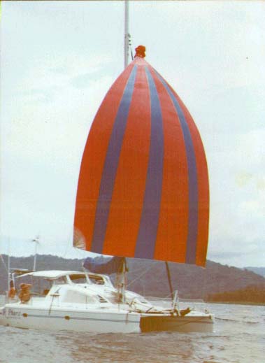
We next moved on to the island paradise of Bali, arriving September 15th. After
several weeks of no wind we elected to make our passage to Bali by the southern
route hoping to find some wind to sail. It was a good decision as we were able
to make a slow two and a half day downwind spinnaker run while most that had
taken the northern passage motored the whole way. The problem with this plan was
entering the Lombac Strait. With a southerly setting, current of up to eight
knots required precise navigation for the arrival at Bali. The other problem
with this strait was a swell coming from the southern ocean meeting the south
setting current, creating steep waves and over falls. As we entered the strait
we had ten knots of wind and 45 knots of sea state. This was the second time in
four years RPhurst took a wave into the cockpit, again with the cockpit hatches
open to the aft cabins. At sunrise, in three meter breaking waves, we needed to
get the spinnaker down, hoist the main and work our way into the lee of an
island in the middle of the strait. Our plan had been to use this island to
block the current, allowing us to cross the area of current without being swept
south. This worked and when we departed the protection of this island we could
make the entrance to Bali International Marina by using a heading 80 degrees
north of our track. This may confusing to many - what we were doing was aiming
the boat north, using the current to carry us west. As we moved south in the
current, we could see our destination by looking off the port side of the boat.
We arrived ahead of other boats that had entered the strait hours ahead of us,
that had tried to cross directly and were swept south with the current. They
needed to motor into a reduced current along the shoreline. One boat had only
held position for four hours waiting for the change of tide, which does not
reverse the flow, but only reduced it slightly. Our small motors do not allow us
to even attempt to motor into such conditions!
Many people believe that Bali is a country, but in reality it is part of
Indonesia. With a mainly Hindu population this island is the only stable area
within Indonesia and for that reason it is a tourist Mecca. Its economy is based
heavily on tourism, and because Bali is one of few places where the surf breaks
over sand as opposed to coral or rock, this brings surfers from everywhere to
enjoy the waves. Some of the nightclubs are open until sunrise with constant
music and the flow of refreshments is strong and cheap. The street hawkers,
selling everything from carvings to tee shirts transport, tours, hair braidings,
tattoos, and anything else can be overwhelming at times. Time will tell how this
bastion of commerce will be able to withstand the pressures of the Moslem
majority of the surrounding islands. As it is it must be seen to be believed.
There are no anchorages on the southern end of the island so our time was spent
in a marina, the only one. It was expensive and dirty with poor service, dirty
fuel and undrinkable water. We then moved to the north side of Bali, it is
almost a different world. With a much slower pace we still enjoyed great meals,
ignored the hawkers while relaxing in a wonderful anchorage.
Our next stop was 382 miles to the northwest. Kalimantan, the Indonesian side of
Borneo, is home to some of the last of the wild Orangutans. The temperature on
the river for our October 13th arrival was 43° Celsius, about 109° F, with equal
humidity.. In the jungle, out of any cooling breeze, it was indeed stifling. We
could only find enough energy to drop the anchor, sit down, put up the awnings,
sit down, get a drink and sit down, with sweat running in streams down the body
while just sitting still. The Orangutans, estimated to be only 5,000 left in the
wild, were a must see on the trip. And what a trip it was. This must have been
nearly the highlight of my entire trip. Many of the cruisers have taken a
three-day trip up the river on a "slow boat". These are long, narrow boats with
small engines moving at five knots. For a fee of about US $25 you are guided,
fed and watched over. Sleeping facilities are open tops, with a roof and
mosquito nets. From the boat you are taken into the jungle to sanctuaries where
captured Orangutans are reintroduced into the wild in three stages. Here they
are fed, watched over and encouraged to mix with the wild Orangutans. The first
stage is where the infants are brought and hand raised until they are able to
move onto stage two, where adolescents and mothers with babies are kept. Then
they are moved to stage three where the adults are cared for. This process takes
years. Cared for is possibly not the correct term. The animals are not caged or
housed, food is provided,but they are not compelled or expected to return daily.
Over time many simply disappear into the jungle, joining wild animals that
become much the same family. When the daily food is brought, the guides and park
rangers call to the animals. Sometimes within minutes and sometimes for an hour
we would watch the canopy for the animals to come through the treetops,
swinging, climbing or just watching us. While they have not been trained to
perform, many individuals have been self taught to entertain, tease and mingle
with the tourists. Under the close eye of the rangers, who discourage contact,
it is a wonder who is watching whom. We were all entertained.
It was here we met Michael, an adult Gibbon, who has adopted the sanctuary as
his home. As we walked down the path into the camp he ran up from behind me,
grabbed my hand and walked as child holding on as we went. He then tired of
walking and with one fluid motion was up on my shoulder for a ride. We later saw
him in the jungle and as Teal broke off a piece of his sandwich for him,
Michael, faster than the blink of an eye, had the large section leaving Teal
with the small torn off piece for his lunch.
During one of our walks in the jungle our guide turned to us, seeming very
excited and insisted we turn around and quickly move back on the trail. He saw,
before we did, a troop of adult animals Orangutans coming from the opposite
direction. The troop was led by juvenile females, followed by adult females,
followed by the "King." King is recognized as the Alfa male of the troop. While
every effort should be made to stay out of his way we did lag back to get some
pictures. I did not realize Orangatans they grew to such a great size and was
duly impressed with his size. His leathery facial mask was as large as my chest.
During our tour of the sanctuary, we learned that food storage is always a
problem for the rangers. If the King decided he should be fed he would merely
break down the very solid wood plank door to the pantry. We were also told that
on one occasion food was missing over time from the pantry, with no apparent
break-in. The rangers set up a watch to witness the thief. One of the Orangutans
had watched the rangers unlock the door, putting the key away after use. The
Orangutan would get the key when no one was around, open the door, eat, lock the
door and return the key to cover his crime.
Despite a ban on logging in the Orangutan sanctuary forest, daily rafts of
freshly fallen trees were hauled up the river to a saw mill. Much of the local
economy is based on this logging and the locals are not willing to diminish
their livelihood by stopping. The local police, stationed along the river,
merely wave as the log rafts go by. The story is told of a time when the park
rangers, who were fed up with the illegal practice, cut apart one of the rafts,
letting the logs float free. Three days later one of their camps was burned to
the ground and has not been rebuilt. Now the rangers wave to the loggers as they
go by.
The fishing in all of Indonesia was excellent. The catch was not. Within ten
minutes of putting out a line a plastic bag would be snagged - sandwich bags to
grocery bags to garbage bags to sheets of plastic. We soon had our limit of bags
and gave up fishing. With plenty of fish remaining in the freezer we did not
need the hassle of clearing our hooks every few minutes. The devastation by the
fishermen was significant. Floating dead dolphins, live turtles caught in nets,
some of which were saved by cruisers, were evidence of the need for education or
at least concern by the fishermen.
South China Sea
The South China Sea is reputed to be frequented by pirates. This reputation
caused us to travel in convoy with other boats. Arrangements were made with
friends to stay near and in radio contact, seldom giving our positions on the
air. All of our preparation was for naught as not one boat had any difficulty
other that the curious fishermen coming too close for a look. Fishing boats were
everywhere. Some dragging nets, some setting long lines, some setting drift
nets, some anchored on their favorite fishing spot. Navigation was difficult
because of their numbers.
Our 621 mile passage through the South China Sea brought the conditions expected
when nearing the equator. Twenty hours of motoring interrupted by one hour of
squall, many very intense, followed by three hours of moderate sailing. Again
our passage was affected by light wind and adverse current. With the wind light
from the northwest, and a strong current against us we made some sixty mile
days, very slow indeed. The clouds would build during the heat of the day and
dissipate their energy as squalls during the night. With impressive lightning
shows we could see them moving across the sky. The Singapore area is supposedly
second only to Florida for the most lightning strikes. Every morning at 4:30
a.m. we would be hit with gale to storm force winds lasting about an hour. The
most mild of these gave us only 38 knots of wind, the most severe 54 knots. This
one did some damage. In anticipation of these and because we were motoring into
very light headwind we would double reef the mainsail and leave the headsail
furled to the third reef before I would go off watch. The wind arrived so
suddenly before I could get the third reef in the main we tore a seam between
the second and third reef. This high wind also caused the wind generator to
fail, again. The light wind and head on current again raised the fuel issue.
When very near the equator I calculated we did not have enough fuel to make our
destination, about 100 miles. Based on this I studied the charts to find a town
or village we could make to get fuel. Having found one I advised our convoy
friends of our decision to change course. One of them was only 8 miles ahead of
us. He had already crossed the equator when he offered to return to pass us the
one can of fuel he could spare. We calculated our positions and determined we
would meet at 00° 00.0' and 105° 30.7'E at 5:00 p.m. for the transfer. As this
is my second crossing of the equator on this trip, I will now be in the northern
hemisphere for the remainder, and represents the second milestone in my trip. As
it turned out this was enough fuel to make the distance to our destination.
Our arrival at the island of Batam, Indonesia on October 25th brought with it
the first of many excellent marinas. For US $5 daily, much less for monthly, the
facilities include swimming pool, tennis court, restaurant, bar, game room,
email and laundry. However, no sail maker, mechanic, electrician or any other
services were included. The marina is used by the Singaporean boaters wishing to
escape the hustle of the big city, so they motor across one of the busiest
waterways in the world to tie up in a full service marina.
Our passage of the Singapore Strait was nerve racking at best. With a traffic
separation scheme designed to reduce the chance of collision between ships
crossed many lanes of vessels traveling in opposite directions, with spacing of
only about six to eight minutes. Timing is critical and many times we found
ourselves closer to ships than I would like to be. I always claim that when I
can count the rivets on the side of a ship it is too close, here we could read
the brand of rivet. We would parallel one lane waiting for an opportunity to
change direction, crossed that lane then parallel again waiting to cross the
next lane. Few cruising boats are fortunate enough to cross several lanes at a
time. After having safely crossed we began working our way towards the marina,
still needing to contend with the crew shuttles, tour boats, ferries, tugs and
many other types of vessels not allowed into the traffic separation scheme. As
we neared the waypoint for the marina it became evident something had changed.
Our 1999 cruising guide and our 1998 chart agreed as to the location of the
marina entrance, however, as we approached the waypoint all we could see was a
container ship and storage facility. In the last two years the industrious
Singaporeans had filled in a large area of ocean and built the facility that now
blocked our way into our safe haven. It didn't take long to figure out that if
we followed the manmade shoreline we would soon reach the marina on the other
side. More evidence that the most up to date charts available should be carried.
Malacca Strait
On November 9th, after a week in an over priced, US $27 a night, Singaporean
marina, we began to move north into the Malacca Strait, another suspected haven
for pirates. We again arranged with friends to stay close and never wished to be
the only boat in an anchorage. We monitored daily reports from Malaysian coast
radio for marauding boatloads of armed pirates, giving the sectors in which to
be most aware. Again, not one boat reported any problem and we patted ourselves
on the back for a plan well executed. Many of these so called pirates do indeed
exist, however, preying mostly on ships carrying cash payroll for their crew,
many of which can exceed US $50,000. These amounts are very tempting for these
crooks, reportedly crossing the straits from Indonesia where they are
unofficially sanctioned. It is a difficult situation to control, as by the time
a report of piracy is reported by a ship and a response has begun the thieves
are once again safely in Indonesian water with new riches.
With the choice of only sailing during the day, islands within distances easily
made by the slowest boat become more important. Again with a light head wind and
an adverse current of up to two knots we would often find while motoring, we
were the slowest boat. Under sail we held our own, so we often made shorter
moves than we would have liked. One morning the wind freshened from the right
direction and one of our friends called on the radio to say goodbye and would
see us at the anchorage. We were there some time before anyone else arrived. It
is nice to sail once in awhile.
It was at this anchorage I was awakened by a clunk on the hull of the boat. Was
it realization of my worst fear of pirates, or worse yet had we dragged anchor
and were now hard aground on the rocks? I rushed to see what was happening.
There was a large dark hull alongside and as my eyes adjusted I could see no
people or movement. As I became able to see more clearly I again heard the clank
and I realized a 30 by 50 foot steel barge had drifted into us. I immediately
positioned myself where I could push against the barge to gain some distance.
Teal was right behind me so I had him start the starboard engine to help gain
distance. As we separated from the barge it again was taken by the current away
from us. I then became aware that it was heading directly toward one of our
friends. It had collided with us on a glancing course but would hit our friend
directly on the bow, likely dislodging and fouling the anchor. I jumped into the
dinghy, sped over to him, pounded on his hull and when he appeared I pointed and
told him to start his engine. I then took my dinghy to push, as best I could,
against the behemoth to move out of a direct collision course with him. Between
his ability to maneuver and what little I could change its course it missed
entirely. Only then did he confide that when he heard me on his hull he also had
instantly thought of pirates. When I returned to RPhurst I looked over the area
of collision to find minimal damage of some small scratches. I then contacted
Malaysian coast radio to advise them of our position and problem. The barge was
being swept into the shipping lane close to our island anchorage. They advised
sight of it on radar and would warn any shipping of its presence. The next
morning we could still see it, apparently having been swept away with the tide
and then pushed back by the reversing tide. Malaysian radio called to thank us
for the assistance. Sometimes you just can't get a good night's sleep!
All along the Malaysian coast the water clarity was so bad it precluded any
swimming. The coast is fed its dirt by many rivers dumping mud and sediment,
along with whatever else can be carried by the river flow, building huge mud
banks that are constantly shifting. We would take anchorage in a small bay along
the coast only to be met by local fishermen telling us we would need to move as
they intended to fish that area this night. We moved, not wanting to offend them
in their fishing area.
As we were still early in the season the northeast monsoon had not filled in, so
moving slowly did not bother any of us. The northeast monsoon is the equal of
the trade winds in most of the northern hemisphere. Most of us think monsoon
means rain but in reality it means consistent wind, often bringing rain during
the transitional periods. By the time we reached the north end of the Malacca
Strait some of the other boats began to breakaway having commitments to arriving
family and friends. We could now make town to town in day hops so we chose to
remain in many of the towns longer than our friends could afford. Some of the
best and most reasonably priced marinas I have seen are along the Malaysian
coast. With full facilities we paid as little as US $5. Being the cheapskate
that I am we often looked for anchorages where the fees were free.
One of the worst marinas was our longest stay, November 18-27th, at Port Klang,
the Royal Selangor Yacht Club. Offering full services and a beautiful building
the onshore facility is very nice. It is in the delta region of the Klang River,
flowing from several hundred miles inland and through several towns and cities.
We found here that the waste was managed by dumping debris into the river to
wash to the sea. During slack tide a frog could very easily have moved from
shore to shore without getting his feet wet. Furniture, plastic, trees, shrubs,
dead animals and anything else that would float came down the river at us daily.
Imagine that which did not float.
It was from here that we traveled by an efficient train system inland to Kuala
Lumpur, the capital of Malaysia. From a distance this appears as modern a city
as may be found in any country. Skyscrapers of glass and steel mingle with the
hawker stalls selling local food items to the locals and tourists. KL, as it is
called, boasts its title as the Singapore where you will not be fined for
chewing gum. Truly, anything you could find in Singapore is available here. Even
more, pirated software, CDs, movies and anything else that can be copied is sold
here for amazingly low prices. The Malaysians claim there is nothing that can’t
be copied, from Dior and Armani designer clothes, to famous artist paintings, to
antique artwork. All is available.
After stops at a few other towns along the way we found ourselves at Langkawi,
Malaysia on December 7th.
After stops at a few other towns along the way we found ourselves at Langkawi,
Malaysia on December 7th.
Langkawi is a wonderful cruising area, claiming 135 islands with sheltered
sailing and many protected anchorages with much improved water clarity. I will
return here for a time in April or May as I can only leave RPhurst in Thailand
for 6 months without paying a 310 percent duty. I do not understand the logic of
politicians to apply such a huge tariff, which causes many of the boats to leave
the country and take their money with them, many not to return. Langkawi is a
duty free port attracting tourists from all over SE Asia for the bargains.
Tourists flock here in large planes and with little else to do, stay at a hotel,
shop, lay on the beach, shop and go home with less money but many bags of
treasures. It is a great place for cruisers to replenish their liquor cabinets.
Need a camera, radio, CD player or any other consumer goods then this is the
place to find it at a good price.
Rok Nok is the first island of Thailand. We arrived on December 12th, staying
only one day. The significance of this island was the clarity of the water.
Anchored in 30 feet of water we could easily see the rocks on the bottom. The
Thai park service comes around once and a while to hassle the cruisers with
demands for anchoring fees. As none of us have cleared into the country yet,
more because there are no Ports of Entry except on the mainland, no one wants to
have difficulty with officialdom. Thailand has another strange regulation. You
must clear out of the country at the same Port of Entry at which you arrived. As
most of us chose to spend most of our time around Phuket, we would then need to
sail 150 miles to weather to clear out. So we clear in at Phuket.
We then moved on to PhiPhiDon Island. This is a small island on which are
hotels, bars, restaurants and all the tee shirt shops and dive centers to supply
the large number of European tourists that flock here every winter. For the
tourist wishing to escape the cold of home, this is a good choice. We then moved
on to arrive in Phuket on December 15th, the main tourist destination on the
west coast of Thailand. The reasons for Thailand being a popular tourist
destination are the low prices, hotels and restaurants to accommodate the hoard
of guests, clear water, and great weather during the northern hemisphere winter.
I will spend one year in Thailand, which ends the planned portion for this
season. I will spend some time cruising the coast and land touring SE Asia, have
the boat hauled to dry the hull, return to the States then return for boat
projects and begin the next leg, which will be to the Red and Mediterranean
Seas.
Bruce Parnham is a 54 year old native Minnesotan, who began sailing in 1987
and was active in Northern Lights Sailing Club (www.nlsc.org), a Twin Cities
organization. He is now in his 6th year of a 10 year circumnavigation on a 38
foot Pro Kennex catamaran. He began in Florida and moved westward through the
Caribbean, Panama Canal, South Pacific, Southeast Asia, North Indian Ocean, Suez
Canal and now is in the Mediterranean. His plan is to arrive back in North
America in about 4 years. Those interested in crewing for Bruce as he continues
his journey through Greece and on his way to the Adrian Sea should contact Rose
Hansmeyer at
mcmaster.tom.c@usfamily.net.
Part Two: Thailand to Greece, will continue in the April issue of Northern
Breezes.