 |
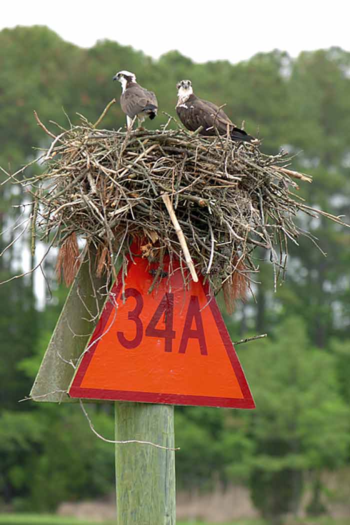
| Osprey family on
channel marker watching
“Victoria” (picture by Al Kiecker) |
Charter Trip on Chesapeake Bay
May 23 - 27, 2005
by Dave Shores
Where ?
The Chesapeake Bay is the largest
estuary in the US, covering 4480 sq.
miles and extending about 200 miles from
the mouth of the Susquehanna River
(north of Baltimore, MD) to Norfolk VA
at the south end. It is 35 miles wide at
the Potomoc River. Two of the five
largest Atlantic US ports are located on
the Chesapeake, and it is home base for
the US Navy’s Atlantic fleet. The
average depth is 21 ft, and it
experiences tides and tidal currents.
For sailboaters these statistics raise
two “flags”: watch the depth of water
under the boat (more about this later)
and watch out for commercial traffic.
Actually, the Chesapeake is a very good
sailing venue. We sailed in the “Lower”
Chesapeake, traveling first north from
the mouth of the Rappahannock River to
anchor in one of several large “creeks”
in the “Northern Neck”, then east across
the Bay to Onancock, VA and Tangier
Island, then back across the Bay to
another creek in the “Northern Neck”
before returning to the home marina
(East Coast Yacht Management,
Deltaville, VA). The total trip distance
over the five days, not counting
fruitless tacks because we were
head-to-wind for three days, was about
102 nautical miles.
|
|
| Osprey family on
channel marker watching
“Victoria” (picture by Al Kiecker) |
The Crew
Five people: Jim Henderson, Dave Shores,
Kris Nelson, Al and Bev Kiecker were
distributed among the positions of
skipper, navigator, crew, cooks and
photographers. All had an opportunity to
drive the boat and all had an
opportunity to crew, but, by mutual
agreement, not all cooked. Cooking is
far too important to trust to amateurs.
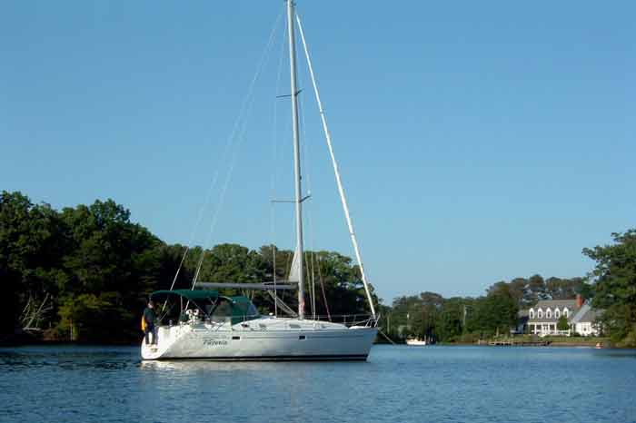
The boat was a Beneteau Oceanis 381
named “Victoria”, with roller furled
135% genoa, an in-mast roller furled
main, dodger and bimini, 56 hp in-board
diesel engine, auto-helm and nice
accommodations. At about 15,000 lbs
displacement (normal for a 38 ft.
cruiser) it wouldn’t do well in our
BBYRA races, but it would have
right-of-way at all mark roundings
(according to the charter master,
tonnage “trumps” the other rules).
A textbook Atlantic coast late spring
“Nor-easter” produced cold, windy, rainy
weather for three of the five days, and
to our frustration, the winds clocked
around to keep the wind on our bow for
three days. While we would have
preferred to sail the entire trip, we
were reduced to motoring much of the
time just to get to our destinations in
a reasonable time to meet our objectives
for what turned out to be an excellent
food and wine program.
Highlights
Nesting ospreys occupied many of the
channel markers, and our photographer
took full advantage, because the ospreys
were not especially afraid of the boat
(see photo). The Lower Chesapeake is
noted for crab cakes, and we sampled
enough for meaningful statistics (3 of 4
encounters were rated 7 to 10 by the
judges). We spent an afternoon at
Onancock, VA, a small town on the
Eastern shore at the head of a navigable
creek. There was a “classic” meeting of
the town elders on the “Liars Bench” at
the dock, no doubt discussing the
skipper’s skill and finesse at docking
(words like “goose with one broken leg”
were overheard). To our astonishment,
the boat’s OWNER, who lives in Onancock,
showed up at the dock to greet us.
Skipper to crew: “I don’t think the
timing is a coincidence”.
However, instead of inspecting his boat for damages, he graciously drove the cooks to a grocery store and back - real southern hospitality.
 |
| “Victoria” at anchor in Dymer Creek, VA (picture by J. Henderson) |
We next visited Tangier Island, whose
two main “ridges” defined the paths of
Main Street and Ridge Street. These
highlands were about 5 ft. above mean
high tide. Unlike Onancock, Tangier Is.
has to date completely escaped the
influx of “northerners” who build big,
expensive homes and resorts and golf
courses. It remains a “waterman’s”
(crabbing) village with about 700
residents (and twice as many boats),
most of whom are named Crockett, Parks
and Shores (no kidding - read “Tangier
Island” by my “distant cousin,” David L.
Shores). The principal modes of land
transport are golf carts, scooters,
bicycles and boots, all perfectly suited
to a thoroughfare width of 7.5 ft. and a
downtown that’s about 3 blocks by 4
blocks in size, residential and
commercial combined. The one auto I saw
fit snugly on the bridge with less than
6 in. clearance on each side. Various
traffic signs announced “Speed Limit 15
mph - Radar Enforced”, but I didn’t see
any evidence of police or of a police
cruiser golf cart. We were also treated
to an astonishing display of boat
handling skill: a crab fisherman came up
the channel at “right good speed” in a
25 - 28 ft power boat, swung around at
speed, shifted in mid-turn into powered
reverse, and BACKED into his slip in a
truly “fluid” pirouette at speed, then
gunned the engine in forward and stopped
the boat inches from the dock. The slip
was defined by four pilings with about 2
ft clearance on each side. The wind was
blowing, the tide was running, and no
fenders were used. Breathtaking! There
is an annual docking contest among
watermen from Tangier and other
communities on the Eastern Shore ($1000
top prize, according to Milton Parks at
Park’s Marina), and this fisherman will
be a competitive entry.
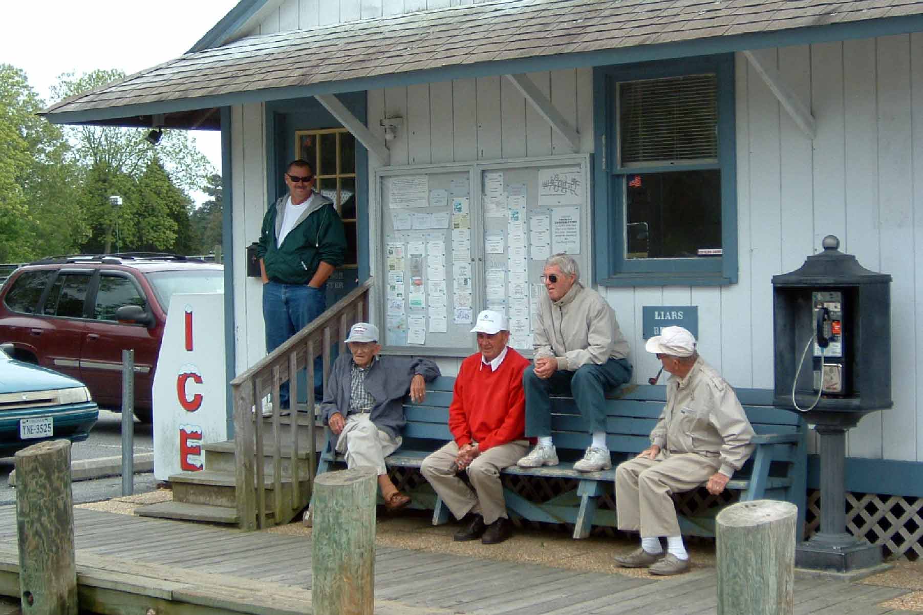 |
| Onancock, VA
residents at town dock
“Liars Bench” (picture by J. Henderson) |
The people we met were invariably
friendly. Hilda Crockett’s Chesapeake
House caters to visitors with a
family-style set-up: no menu, one price,
the food comes on platters and dishes
which are passed around, and the crab
cakes and clam fritters were rated “best
of the week” after the judges awarded
style and atmosphere points to break a
tie with a fancy “in-town” restaurant in
Norfolk.
Quotable Quotes
All trips produce “moments”; here are a
few of ours:
Charter broker lady whispers to a female
crew while we are checking out the boat:
“are you sure you want to go out in the
Bay with these guys?”
Navigator to GPS about ½ hr into the
trip (with some frustration): “which way
is North?”
Navigator to Skipper, 1 hr into trip:
“We’re not getting into trouble very
quickly” A few minutes later, the engine
dies. (It was repaired by the Charter
Master “at sea”.)
Picture 3 guys trying to direct one
woman on her first time at the helm
(with significant wind and waves),
Helmsman to all: “I REALLY don’t like
this ...”
At Tangier, navigator to all: “...some
of my best friends are tarts...”
(Context was a discussion of food)
Skipper to Helmsman: “let’s tack NOW!”
Skipper to Helmsman, after a long watch
for crab pot markers: “There’s penguins
in the water ahead.” (Monotony breaker
or visions?)
Last day, Skipper to Navigator: “where
the heck are we..?” [Navigator response,
“keep calling out any penguins you
see!”]
Helmsman (with some intensity) to
Skipper: “we’re at 2.5 ft depth and
RISING”
Navigation
Navigating the Chesapeake Bay can be a
challenge, because of shallow water
extending a mile or more offshore, and
because of major shipping channels and
prohibited areas (e.g., unexploded
ordinance, sunken ship bombing targets)
to be avoided. On the other hand, there
are numerous navigational “position
markers” and the channels into rivers
and creeks are clearly marked. We used a
detailed chart book (lays flat, easier
to handle, and has 1 minute grid lines
compared with 10 minute grid lines on
paper charts), a “Cruising Guide” and a
hand-held GPS. Although we had picked an
approximate track weeks before the trip,
we modified it daily. The process that
worked well for us was to pick a
destination each day. Then the navigator
in-loaded waypoints in the GPS for major
position markers along the way and for
markers at the entrance to channel. Both
kinds of markers also appeared on the
internal GPS map, so it was easy to
create waypoints. Using the “go-to”
function the GPS generated our course
bearing (magnetic) and actual heading.
It also drew a track on the internal
map. Driving with the engine, the course
and heading would be essentially the
same, but under sail they differed as we
tacked back and forth. The GPS also
showed our present position as an icon
on its map for comparison to the “go to”
track. On an (approximately) hourly
basis, we also plotted our position on
the chart book. Importantly, as a
reality check, we also visually
identified each position marker as we
passed by, and used it to check our
position on the chart book. We found the
boat’s compass deviation compared to the
GPS was as much as 20° in some
directions, and for the autopilot
compass it was as much as 15° in the
same directions. To put this in
perspective, if the distance from one
position marker to the next were 20 nm,
then a compass error of 20° would cause
the boat to miss the next mark by 6.8
nm, a distance about twice the east-west
dimension of White Bear Lake, MN.
Likely, all but the tallest markers
could not be seen at this distance.
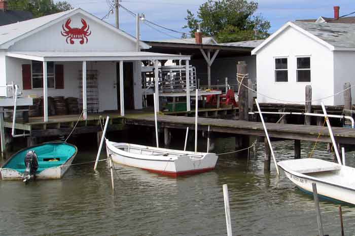 |
| Crab Restaurant at Tangier Island (picture by D. Shores) |
Driving up a creek or river channel to
an overnight anchorage required a
different sort of navigational mindset.
In most cases the channel was about 100
- 150 ft wide and around 7 ft (water
depth below our keel) deep. Because the
terrain is quite flat, the channel
meanders. One side of the channel is
marked by a red or green numbered
triangle on a post about 10 ft above the
water. Generally, the channel markers
were located a mile or so apart or where
a significant turn was required. The
rule is: “Red on Right on Return”
(return meaning from the sea or
up-river) and it’s very inflexible. The
most common reason for grounding is
cutting across a bend or missing a
channel marker. We grounded twice, but
since we were going slowly under power,
we were able to back off. We had a near
miss on the last day, because on heading
back out the channel into the bay, at
about a mile offshore, we mistook the
next marker a mile ahead as a position
marker. So we turned south, and … (see
the last “quotable quote”). A great save
was made by the quick reaction of the
Helmsperson who did a hard reverse and a
slow turn toward open water.
Elements of a successful week-long
charter
(1) a person or persons who can handle
the boat competently,
(2) a competent navigator,
(3) a good cook.
If the functions are fulfilled
adequately, not necessarily in that
order, then good people who like to sail
will likely get along for a week. At the
end of the trip we were still good
friends, so by that standard, and
several others, the trip was a success.
Many thanks to fellow charter members
for ideas and pictures incorporated into
this article.
Dave Shores teaches sailing classes
for Northern Breezes Sailing School
during the summer and learning minds as
a professor at the University of
Minnesota during the school year.