New Products
New Marine Stereo System is Loaded with Extras
|
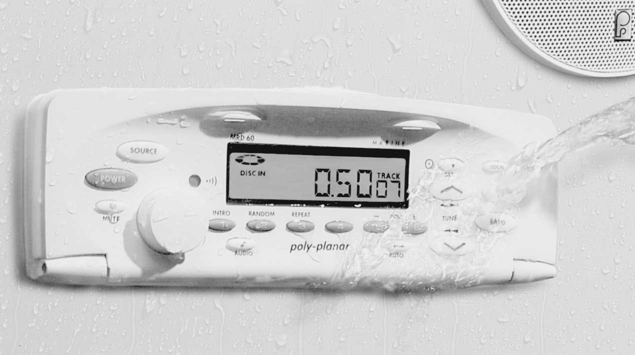
It’s no secret that some boat stereos are merely automobile radios with a makeover. After years of audio research and product development, ply-Planar has now introduced a completely new, watertight stereo system designed and built exclusively for the marine environment.
With a waterproof faceplate to eliminate the need for a splash cover, the flush-mounted model MRD60 is a true AM/FM/CD marine stereo. Its patented waterproof volume control provides nearly infinite adjustment of sound without distortion at high levels. All electronic circuits are thoroughly marine-coated to provide additional protection from the elements. When rough seas are encountered, a built-in shock-resistant mechanism ensures skip-free CD operation.
A wired remote keypad provides control of all radio and CD functions, plus an intercom for communicating with different areas of the boat. If wireless control is desired, an infrared remote can be used to access the system from a distance.Poly-Planar’s MRD60 AM/FM/CD watertight receiver should be available in August, 2001. Suggested list price $450.
From Poly-Planar Inc. 215-675-7805 or www.polyplanar.com.
Maptech Announces Pocket Navigator - GPS Ready - Software for the Outdoors Topographic Maps and Nautical Charts in Your Handheld Pocket PC
With Maptech’s new Pocket navigator software you have the key to outdoor adventures in your hand. Now hikers, fishermen, hunters, boaters, sailors, and pilots can transfer genuine USGS topographic maps and NOAA charts to their handheld Pocket PC.
Imagine this: plan your day trip at your desktop using Maptech’s Terrain Navigator or Digital ChartKit 2001 and storage which is enough for 5 to 10 topographic maps or charts - more than enough space for the maps you will need for the day or weekend. Add more flash card storage and download your entire boating season charts, fishing hot spots, hiking and hunting maps.
At this time both the Palm and Visor operating systems cannot display the detailed mapping data found on genuine topographic maps and nautical charts. When you’re out in the great outdoors, most people want and need the full, rich, raster map images instead of the simple vector, line drawings that are used in street maps. Pocket Navigator is the outdoor navigator for on-water, on-land, and in-the-air travel when used with Maptech maps and charts.
Pocket Navigator software works with Maptech digital charts and maps. Terrain Navigator and Digital ChartKit are sold separately. Operation requires a Pocket PC handheld. Visit www.maptech.com for details and the Pocket Navigator tour.
Call Maptech at 888-839-5551 or visit www.maptech.com.
Versatile Wind Vane Offers Dual Mounting Options
 |
Regardless of the size of the vessel, skippers of sailing craft need an accurate reading of wind direction. Now, pilots of small sailboats can mount a Black Max wind Direction Indicator from Davis Instruments and see at a glance how the breeze is blowing.
The versatile Black Max quickly attaches to the booms or masts of most small craft, such as Lasers and Sunfish. Its unique mounting system, which inclueds a stainless steel mounting arm and set screw, adjusts to fit booms and masts from 1-1/2” to 2-1/2”.
The high-impact wind vane and mounting base are designed to withstand the rigors of small boat sailing for years. The length of the vane is 8”, and the Black Max is packaged in an unbreakable storage tube.
Davis Instruments offers an extensive selection of unique power-boating, sailing, fishing and outdoor gear, as well as precision weather instruments.
Suggested retail price of the Black Max Wind Direction Indicator is $23.95.
From Davis Instruments, Email: info@davisnet.com.